High-performance vector track rendering for multi-stage rides, ultra-marathons, and trail runs.
Standard DOM map markers struggle with thousands of GPS coordinates. Kinetiqo uses Leaflet's HTML5 Canvas renderer to plot complex multi-stage GPS routes smoothly without browser lag.
/tiles/osm/...): Built-in Python caching proxy that strictly complies with OpenStreetMap tile usage policies.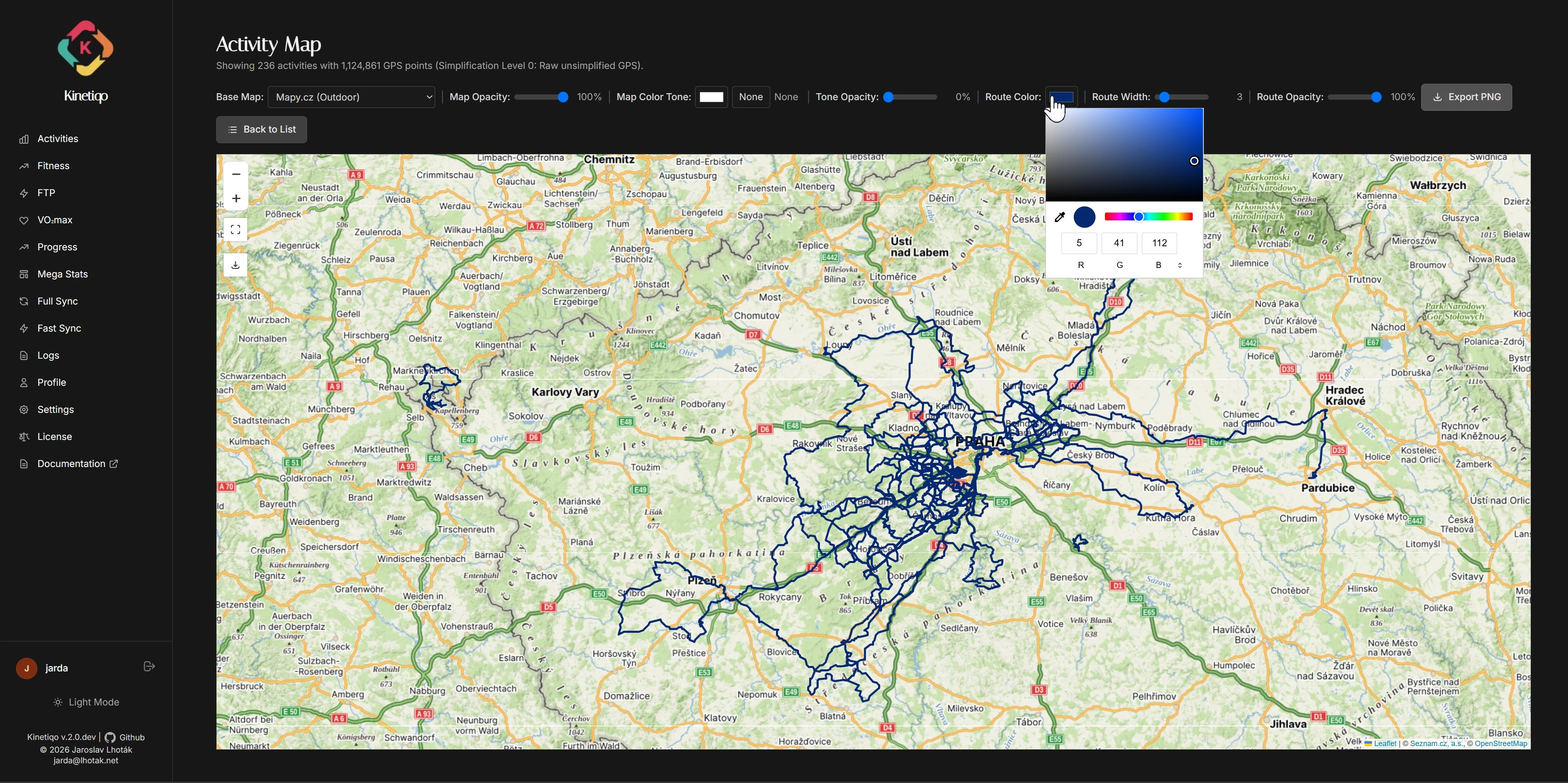
Kinetiqo gives you full aesthetic control over how your maps and route polylines are rendered:
Switch between OpenStreetMap, Mapy.cz, Thunderforest, MapTiler, Geoapify, CARTO, and Esri layers. Provider keys are configurable and unavailable key-dependent layers are clearly disabled.
Browse All 16 Basemaps & Specs →Customize polyline stroke colors (Strava Ember, Neon Cyan, Emerald, Electric Purple) and line weight thickness for maximum contrast over satellite or topographic terrain.
Compose the exact viewport you want, enter fullscreen when useful, and export a polished PNG with attribution while controls stay out of the final image.
Adjust polyline transparency from 10% to 100%. Lowering opacity lets underlying road names and topo contour lines show through overlapping routes.
Apply real-time map tone filters (Sepia, Dark Space, High Contrast, Hue Shift) to match your dashboard theme or create dramatic map screenshots.
Distance-based decimation via GPS_SIMPLIFICATION (levels 1–10) reduces payload sizes by 10–30× when rendering thousands of route points on low-power devices.
